Learning to fly, but I ain't got wings

Month: August 2018

A little more time building with a slight hitch

Today was another time building flight.  I still need a little more hood time and some more cross country before I can start my final checkride prep lessons.  Also a whole lot of studying but that is another story.

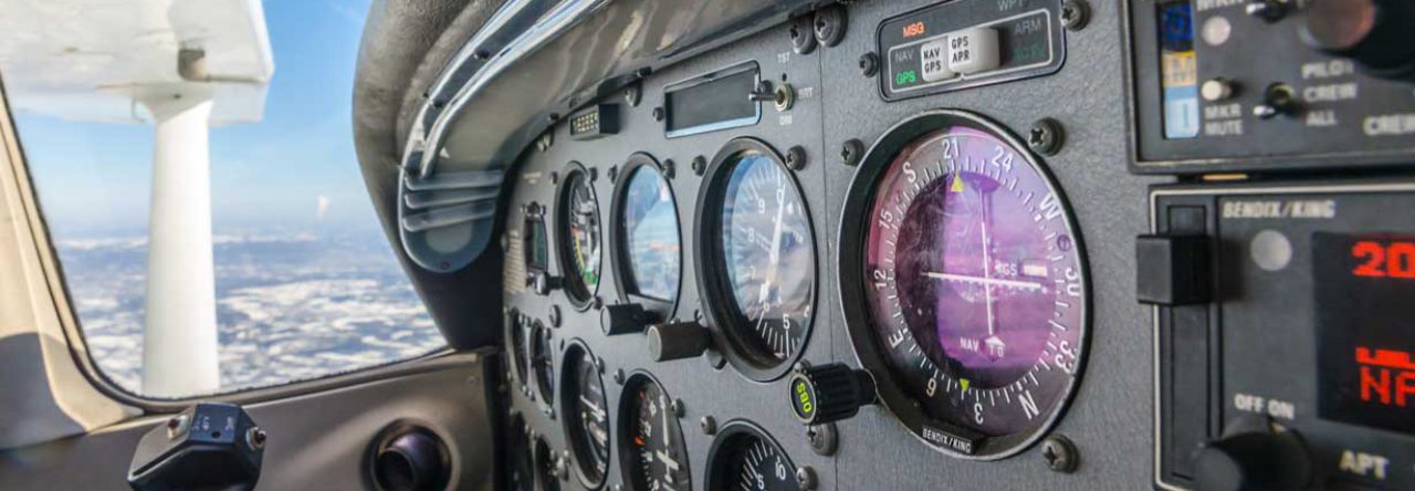
Todays flight will take us from TTA -> OCW (Washington-Warren) -> CRE (Grand strand) -> TTA.  Today’s weather was to be severe clear for most of eastern North Carolina with some scattered clouds starting around noon.  On our first leg from TTA to OCW the predictions were correct.  Severe clear weather, though I was under the hood to get my hood time in.  I didn’t get to enjoy the clear hazy skies.

Once we were on the ground at Washington Warren, we got some fuel, used the restroom and then back in the airplane to head south towards North Myrtle beach.  Pretty uninteresting for the most part.  I played with the VOR tracking along the Wilmington VOR as we would pass to the west of the terminal area.  My safety pilot alerted me to some clouds ahead around 4000′.  We were currently at 4500′ but decided to climb to 6500′ to make sure that we would clear them with ease.

A few minutes after we leveled off at 6500′ something interesting occured.  The engine ran rough for just a second.  Then about 20 seconds later, again a short rough spot.  Then again and again.  Ok at this point, I have Wilmington international to the left and a small airfield to the right.  We have altitude, 6500′, and options.  At first I thought, duh, mixture.  So I adjusted the mixture but the problem persisted.  Next, I thought, ok carb ice?  I have never experienced carb ice before and the conditions seem to be right for this phenomena.  I turn on the carb heat and saw the expected drop in RPM.  The engine roughness disappeared.  Ok, weird.  I thought that carb ice manifested in a slow rpm decrease over time.

At this point, I told my safety pilot that we were going to head back home.  There were no clouds back to the west and we had lots of airfield options.  We discussed dropping down to a lower altitude to see if the problem persisted but I chose to keep the altitude we had unless we were forced to give it up.

After a few minutes on route back to TTA, I tried to turn off the carb heat again and before I got the knob fully pushed in, immediate roughness. Odd?

Another thought that crossed my mind was that maybe the air intake vent was somehow clogged.  Bird, bug, trash?  Carb heat gives you a backup air intake source, that would explain why there was immediate roughness when carb heat was disengaged.

During the next 30 minutes, I would intermittently remove carb heat to see if the roughness persisted and it did.

Assessing the situation:  We are at 6500′, gliding distance to 2 airfields and we have airfields lined up the entire route back.  Airplane is performing fine with carb heat applied.  I made the decision to continue on with the caveat that if anything else seems funny, we make a precautionary landing.

We also made the decision that we would test the carb icing theory by descending down to 4500′ closer to home, within gliding distance of KHRJ. That way if we didn’t like the situation we could be on the ground at Harnett County quickly and safely.

Sure enough, once down to 4500′, I removed the carb heat and everything ran fine the rest of the trip.  I made a point to talk with our chief flight instructor and my IFR instructor to make sure that I was approaching the situation in a sane and safe manner.  This was a learning opportunity and just because things turned out fine, doesn’t mean there isn’t a ton to learn from it, good or bad.  I wanted to debrief and make sure there wasn’t something else that I could have done better.

I had sufficient power, I had altitude and I had options.  In the end, I made safe logical decisions.  The lesson here is that you should rely on your training, work the problem and go through your options.  I’m sure some will look at this and say, “Pfftt, that is nothing, this one time…..”.  When you’re a relatively low time pilot, events like this, no matter how small, test your training.  Hopefully, I added a little bit more to my experience bucket and didn’t lose too much from my luck bucket.

Today’s flight had a tiny bit of nerves for a bit but I got to fly and I learned something valuable.


Long IFR cross country, from time to think to under pressure

Today the weather and schedules lined up for me to complete my long IFR cross country requirement.  With a high pressure dominating much of the area, it was beautiful blue skies today.  I spent nearly the entire time under the hood with the exception of a touch and go.  Oh, and I looked up as I flew through a single cloud on vectors to ILS Y 35 Approach.  Flying through clouds are cool so I took the option of looking up for the occasion.

Ok, so the night before, my instructor said to plan for KTTA -> KILM (ILS) ->  KFLO (VOR ARC) -> KTTA (RNAV) with a 9am departure.

So, here was my first, sort of, mess up.  I performed a intermediate NWKRAFT on the flight plan.  NWKRAFT is a flight planning tool:

Notams
Weather
Known ATC Delays
Runway lengths
Alternates
Fuel requirements
Take off and landing distances

Once I got to the fuel requirements, I plugged in 3.5 hrs, which is typical for fuel to the tabs.  I planned like we were going to file multiple times with a fuel stop either at KILM or KFLO.  I Should have asked if we were going to top off which would allow us to fly the complete trip without refuel.  Because of my poor assumptions, this stuck in my head for the initial configuration of our flight plan.  More on that later.

After preflight, I sat down to look at weather briefs for our entire route.  I plugged in 2 flight plans, first KTTA -> KILM and then KILM -> KFLO.  The first reason I did this, as stated previously, I figured that we were landing at KILM. Second is because of the way foreflight briefing gives me the proper notams and FDC Notams.  It also helps me compartmentalize each segment to make sure I don’t gloss over things.  Sometimes with the foreflight briefing, it is easy to miss some notams if you don’t plug in the actual route airport as the destination.

Ex. If you plugin KTTA -> KILM -> KFLO -> KTTA, then you will get a nice break down of notams for your departure and destination.  In this case, both are KTTA.  You have to dig out the others from the enroute data. By creating separate briefings for the legs, I get better Notam breakdowns.  Note to self, look into flightplan.com

Ok, after briefing, I plugged in the entire route into the flight plan so that I could file our IFR Clearance.  Once my instructor looked everything over, I clicked the file button.

On a side note, there is a lot of satisfaction in filing IFR flight plans.  I am not sure why but I think it is really cool.  It is also neat that within a minute or so, I get an email with my expected route. Makes me feel professional…. ish.

Before departure, we would need to top the tanks off in order to be able to complete the entire trip without refueling. It is really annoying that we can’t call for fuel anymore.  It seems that our club is being unjustly punished but that is a story for another blog post. Oh, and the pump refused to give me a receipt so that added insult to injury.

Ok, so once we were fueled up, I performed the preflight runup and checks. So here is where my planning the night before messed me up.  I plugged in KTTA -> KILM and left it as that.  In part of my mind I said, well, I am going to call for my clearance in a few minutes, I will change it then.  However, when I was ready, my instructor said, “It’s a pretty clear day why would we waste time on the ground”  Good point, we can pick it up in the air.

We taxi’d and departed.  I went under the hood and my instructor gave me vectors around the pattern until “Proceed direct”  After a hint, I resequenced the GPS direct.  After gaining some altitude, I called up Fayetteville approach and picked up our clearance.  “N72675 cleared to Sanford as filed, climb and maintain 5000”  At this point, I should have rechecked the flight plan in the GPS and resquenced accordingly. But nay, I did no such thing and this would cause me a moment of strife later in this adventure.

The trip to Wilmington was pretty uneventful.  I configured the autopilot and my instructor and I had a quiz session on IFR Chart symbology. This went pretty well but I could tell (I’m sure he could as well) that I was rusty. Time to hit the books.

Once we were closer, we were given vectors for the ILS Y 35 approach (As we previously requested).   Nothing unusual about the approach and we did a quick touch and go then runway heading back up to 2000.

Now this is where my ineptitude of the flight planning comes into play.  Now remember I just had KTTA -> KILM sequenced in the GPS.  Once I was handed back to approach, I was cleared direct to KFLO.  Ok, at this point I had no idea what the course was and fumbled to input the changes into the GPS.  At about the time I get everything situated I hear, “N72675 are you going to turn direct to KFLO?”  I think at this point my instructor keyed the mic to respond that we are turning now.  I wish I could say that it was a great learning experience that would forever be etched into my brain but sometimes it takes multiple times to really get the point across. More later, lol.

Once on course it was pretty boring to be honest.  I started thinking about what was next and configuring for the ATIS at KFLO and that I needed to use the restroom.  I flushed that from my mind ( pun intended) and began setting up the radios for the VOR.  Even though we were on the GPS for the VOR Arc, it is good to have these things in case something goes wrong.  I pulled up the VOR approach and briefed as much as I could since we didn’t actually have the approach clearance.  The point here is that I was trying to stay ahead of the aircraft where I could.  I felt like I did a fair job on this flight in that regard.

Once cleared direct to JONAP for the VOR Arc, I finished the brief and we discussed the entry and when I could descend down to 1100.  This comes down to when you’re established on final. (And definition of established)

The Arc went fine (The joys of GPS), and I flew down to circling minimums.  I won’t go into detail but we had some issues with tower really really not wanting to let us just break off the approach and continue back to TTA.  They seemed to really want us to fly the full low approach over the runway.  We ended up circling around to runway 9 and then on climb out we were handed back over to approach.

“N72657, radar contact 5nm east of Florence Region, one thousand eight hundred. Climb five thousand and let me know when you can copy an amended clearance”  Okydoky, I cleared my kneeboard and responded “N72675 ready to copy”.  “N72675, cleared to Sanford via Direct Sandhills VOR, Sierra Delta Zulu, then direct Sanford”  I repeated back the clearance and now we need to resequence for Sandhills.  Like before, it took me a minute or so to resequence the GPS and I hear, “N72675, are you turning direct sandhills?”  Again my instructor keyed the mic and said we were turning now, just had to clean up the GPS.  This time the controller said no problem take your time.  However, this was the second time this happened.

I recognize that the second time was really due to an amended clearance and that is justifiable but the first time was completely my error in not being prepared.  We then used this as a teachable moment and discussed ways of handling it.  I could have just put direction Sandhills in the GPS then made the turn on course and after established finished up with the rest of the flight plan.  The other thing that I could have done is asked ATC for an initial vector and that I would let them know when I could resume on navigation after the resequence.

The big takeaway hear is that I need to have my flight plan in order and also I could use some more time practicing with the GPS.  I will spend some time on the Garmin simulator.

Once on with Fayetteville approach, we were cleared direct TTA through a restricted area.  My bladder was extremely pleased as this cut around 10-15 minutes off our flight time.  This was wonderful as the pressure was literally building inside of me.

We were cleared straight in  TTA RNAV 3 approach, my bladder yet again thankful that we didn’t have to perform the procedure turn.

After landing and a quick trip to the potty, my instructor and I debriefed.  Other than my flightplan snafu and one missed radio call, I did pretty well.  I think that he was pleased.  He said that my radio work is good enough for checkride and that I should start the hardcore bookwork as my checkride is on the horizon.

I currently still have 5.1 cross country left and about 6.5 hood time that I need to get done before.  Checkride prep should cut into half of that time so I will have another building flight time post in the near future.

I really like IFR flying and plan to fly in the system a whole lot in the future. But for now, it is crunch time.  Time to take all of what I have learned and finish the rating.  For today however, I got to fly and that is always cool!

Das radio kaputt and zero zero weather?

Disclaimer: Maneuvers discussed in this post are for training purposes only!  Do not attempt without the assistance of an experienced and qualified instrument instructor.

I have been focusing on my cross country time building lately. Time to get back in the cockpit with my instructor. As the title says, Das radio kaputt!!  Today’s lessons were about emergencies.

I had a feeling something was up when my instructor texted me that I need to plan a flight to Siler City (KSCR) and that I needed to plan an alternate because the weather at TTA was zero zero.  The translation here is that the airfield is completely weathered in, ceilings of zero ft and visibility of zero ft.  Think of thick fog.  I am sitting next to a window, staring at the clear blue sky thinking my instructor has cracked.  Not really, I figured it was a *hint* *hint*.

I remember us discussing early in my training, one day I would perform a take-off with foggles on and also do a zero/zero landing with foggles on.

This is not something that you want to ever have to do. The idea is to prove that if you are ever faced with dire circumstances, this is a tool in your bag that could potentially save your life.

It wasn’t all peachy, as I said before, today was about emergencies.  I am also getting to the phase in my training where I should be tightening things up.  Today proved I still have a little ways to go.

During the run-up, I was trying to get back in the groove, setting the radios, testing the autopilot, etc.  During the autopilot disconnect testing, I got two of the disconnect methods:

  • Turn off the autopilot from the autopilot itself
  • Disconnect button on the yoke

I missed the other two methods:

  • Trim switch will disengage
  • AutoPilot circuit breaker

I didn’t take this too hard, I have never really used the autopilot and the last time I fully tested it was my first lesson.  However today we were going to use it, so it must be tested.

Before take-off, I finished setting up the radios, flight plan KTTA-KSCR (More on this), run-up, etc.

I wrote C-R-A-F-T on my kneeboard in anticipation of getting my mock clearance and then I muttered something like, “Well, I guess I can taxi to 21 before getting the clearance in case it is an immediate departure clearance”. Teachable moment coming.

Once I taxi’d to Runway 21, I then confidently announced.  ” ********* approach, 72675 would like to pick up my clearance”.  “uh, 72675, where are you?”  Doh, I needed to say that I was TTA and positioned to take of runway 21.  After this reminder I completed the query. “Ok, 72675, stand-by”  Teachable moment coming!

My instructor then says “Well, they put you on hold for a bit, as they do, and now about 10 airplanes lined up behind us waiting to take off”  I should have gotten my clearance on the ramp and not wait until I was ready to depart.  These are all good nuggets and will become more engrained as I fly in the system more often.

“72675, cleared to LIB VOR, Altitude 3000, stay on ***** approach frequency, squawk 1200, current time 1645, Clearance void by 1647, call me back if not off by 1649”

I read back the clearance and then made a mistake because I was a little crunched on time to get lined up on the runway for a foggles on, zero/zero take-off. I imagine my instructor did this on purpose as well.  Previously, I configured the GPS for KTTA-KSCR not KTTA to LIB VOR.  Once I departed runway 21, I then realized, I have no idea what my course is and quickly started fumbling with the gps. In a turn no less.  I overshot the course by about 45 degrees.  I hear my instructor, “Uh 72675, where are you headed?”  What I should have done is turned to a point North westerly then configured the gps course.  Trying to do it in a turn was too much load on my brain.

Once on course, I hear my instructor doing his best garbled transmission play acting.  It took 2 or 3 times before I responded and then we walked through what to do.  I was able to slowly work through possible solutions:

  • Try my other radio, nothing but static
  • Key the mic and see if others can hear me to relay, nothing but static
  • Switch to another approach frequency, nothing but static
  • change to guard channel 121.5, nothing but static

Now this is where we follow lost comms procedures. At this point I feel a little bit like this guy:

We were only cleared to LIB VOR.  So we have to hold there until our expected arrival time.  We take our departure time and then add our enroute time to the destination and that will be the time in which we can leave the hold once we reach LIB VOR.  As we neared, it was apparent that we would arrive to the VOR after this expected time, so we can perform the procedure turn and then begin inbound to land at KSCR.

As I neared the Circle to land minimums, I goofed by trying to fly the missed too early.  Another good lesson, fly the minimums until you reach the airfield, because the clouds could clear up right when you arrive.  Anyway, back on the missed I turned toward the LIB VOR and we discussed the sector minimum altitude since I am not on an airway. I blew this at first as well because I wasn’t paying attention to which side of the airfield I was located.  Another good lesson.

We discussed, well, what next?  We filed alternate at RDU but it looks socked in and TTA is improving, so we load up the RNAV 21 approach with OZOPE IAF and I turn back toward TTA.  At this point, I ask questions about being predictable to ATC.  They already know we are lost comms since we are squawking 7600.  They are busy clearing airspace around us as we move so it is important to be predictable.

Amazingly, the radios come back and I get a lesson on how the autopilot works. We set up for a coupled RNAV 21 approach.  Honestly, I spent the whole time trying to second guess the autopilot, but it was nice to have free hands and a little head room to focus on getting the approach ready.

Once we are pointed at our final approach fix, my instructor says, “Hmmm, no LPV,  LNAV only, that’s odd”.  With no glideslope, I would need to perform the stepdowns using the autopilots altitude control.  No riding down the glideslope for free.  This was good practice on how to get stepped down and still using the autopilot to help out.

At about 2 miles out, I disconnected the autopilot, flew to minimums and then performed a touch and go.

Once back in the air, I was given vectors back to the RNAV 21 final approach fix at WIZNY.  Magically, LPV was now working again.  Without going into detail, my instructor disabled WAAS before I loaded my previous approach and enabled during the middle of said approach.  However, in order to get LPV back, you need to resequence the approach.  Once we added the RNAV 21 back into the gps, LPV was working again.  Another good lesson because you never know what the previous pilot may have done or previous instructor… or your current instructor!

Now the fun begins. The moment of truth.  Am I ready?
I am on the glidepath for a zero/zero landing on Runway 21.  I slow the airplane to 70 and drop 10 degrees of flaps.  This configuration would take me to the promised land.

I was hyper focused on keeping the vertical and horizontal lines on the CDI perfectly on target.  There was some drift left and right but not too bad.  I got a little low on the vertical and compensated by being a little bit high.  That is better than low but need to keep it close

I wasn’t nervous but really sweaty!

We neared the runway, I am holding the vertical and horizontal needles on the CDI in the middle.  We are now nearing the touchdown altitude of 230.  At around 245 on the altimeter, I begin the round out and hold level….. holding …. holding….  holding, then I feel the wheels touch down.  OMG!  We are on the runway. Looking up from my foggles, we are about 10-15 feet left of centerline but safely on the runway!  I did it!  It was a crazy cool feeling that I was able to make this happen fully under the foggles.  I didn’t peek, it was a complete surprise.  Honestly, one of my better landings with my instructor on board, lol.

As we taxi’d back, I was on cloud nine.  I had so much to unpack on this lesson, that I needed to wait a few hours and dump my thoughts into this blog.  To be sure, I missed some details but hit the big lessons for today.

I don’t ever want to be in an emergency situation where I would have to land in zero/zero conditions but it is good to know that I do have the capability and it could potentially be a life saving tool.


Dodging Weather, Flying High, Always Learning

Today was yet another time building flight but it became so much more.  Dodging weather and ADM (Aeronautical Decision Making) became the lesson of the day.  The weather forecasts look pretty good for this flight.  Early morning fog would burn off to few/scattered around 10,000′.  It was also forecast that near the NC/SC border, clouds would start to build around 1pm and a chance of some thunderstorms. It was to remain pretty clear, scattered 6000 along the coast. We made the decision to head south first to avoid these build ups.

We planned a route TTA -> CRE (N. Myrtle Beach SC) -> KEDE (North Eastern NC Coast) -> TTA.  As with anything in aviation, you must always be flexible.

Before taking off, my safety pilot and I briefed the proposed trip and talked about alternates along the route.  We also agreed that we would look at the weather at CRE and revise if needed.

As we departed TTA, the sky was quite clear with some scattered clouds in front of us we climbed up to 7,500′ to remain VFR.  As we neared our destination, we could see that the cloud layer would dissipate over our destination.  I was under the hood for most of the flight and my safety pilot would give me vectors and descent instructions until we were around 10 nm from our destination.  CRE tower gave us a right base entry for Runway 23.  Landing was ok, not my best not my worst.

We taxi’d to the FBO for fuel and to check the weather.

As we looked at our route, there were still quite a few low scattered clouds over our next destination EDE.  I made the determination, proved incorrectly, that it was still some of the lower cloud layers burning off and that they would move out as we traveled.  Everything to the west of this line seemed to be vfr with decent cloud heights.  We decided that we would takeoff with EDE as the destination and along the route we would evaluate the weather and be willing to land at one of the airfields more westerly if needed.  The lesson here is always have an out.

As we departed, there was a perfect hole in the clouds to climb up on top.  Our target altitude was 5,500′ but it would seem we would need to go higher.  I informed ATC we would be climbing to 7,500’… then after a bit 9,500′.  In a Cessna 152, I was in rare air.  I think the highest I had ever been, in the mighty 152, before today was 5,500′.

About 30 minutes into our 2 hour flight, it was becoming obvious that the weather was not getting better at EDE and actually getting worse.  We were also starting to see radar echoes and possible cells forming.  After a couple minutes of talking about diverting to a westerly airport we made the call to return back to TTA.  We knew that the more west we flew, the better off we were.

I keyed the mic and informed ATC that we would be returning direct to TTA.  They asked if I wanted to stay at my odd altitude or change to an even altitude.

Note: We were changing from an easterly direction to westerly direction so VFR dictates that we fly even thousands plus 500′.  I imagine, he offered the odd altitude as a courtesy, since the clouds were obviously in our way.

We said we could take an even altitude so he asked us to descend 8,500′.  I requested instead of 8,500′ we could do 10,500′ for cloud clearance.  Once approved, we started the climb from 9,500′ to 10,500′.  In the summer, climb performance is a bit lowered in general and as you climb higher, the performance degrades even more.  So we were only climbing at about 200′ per minute at an airspeed of 70 kts. You also must really work the mixture at this altitude. As the air becomes thinner, the mixture become excessively rich.  You must lean out as you climb.  This isn’t unusual but since I haven’t been this high before, it was interesting. Much easier in a SkyHawk when you have an EGT to help out.

Our path back to TTA would take us over familiar territory, albeit a lot higher.  We would cross over KFAY on our way back to TTA.

At about 20 miles from KFAY, I made the request from approach to start our descent.  I was concerned that we would have fewer holes below us as we approached and we had a nice path down in front of us.  It also looked like clouds were scattered 3500′ the rest of the way to TTA. (We ended up flying 2500′ because clouds were lower than expected)

Approach approved the descent and handed us off to Fayetteville approach. Once on with Fayetteville approach, things started getting interesting.  Lots of chatter on the radio with route deviations due to building convection.  At one point we were given a vector toward restricted airspace while we were over KFAY.  The vector was so that another aircraft would have time to climb over us.  As we neared restricted airspace, my safety pilot suggested we give it another minute and then nudge approach that we were close to restricted.  I agreed and at the same time, approach told us to turn right and resume our course towards TTA.

As we neared TTA, things looked pretty good.  No echoes, there were planes in the patter and one of our club planes flying over top of us to join the RNAV 3.  All of this was carefully choreographed by approach.  In order to cede some room for the aircraft in the pattern and the aircraft on the RNAV, we briefed an approach from the east.  The idea was that we would fly east of the field and cross over mid-field and join the downwind for runway 3.  This would give the RNAV traffic time to get in and allow us to observe the pattern to safely enter.

We entered the downwind, and followed the RNAV traffic for a landing on runway 3.  I was a little fast because I was concerned about a possible tailwind.  This caused me to balloon slightly but I let the aircraft settle in for a soft landing.  Again, not my best, not my worst.

As we tied down, my safety pilot and I debriefed what we did and what we learned.  The biggest takeaway was that you always need an out. I think we did well in this regard. We had backup plans and then backups to those. We are also pretty lucky in that we have ADSB with moving maps and ability to get en-route weather.  Weather that you see on the maps are delayed but it definitely helps you make strategic decisions. By the time we see small echoes, they are probably magnitudes larger in reality.  You can’t rely on the data to pick your way through storms but you can use it to avoid them from a distance.

It was the first time flying with this particular pilot and I think we worked well together. I didn’t get as much flight time as I wanted today but I learned a lot more than I could have imagined.  I think we added to our bag of experience and saved some from our bag of luck.

Above all, I got to fly an airplane today, at 10,500′ no less.  That is always cool!

Big thank you to my awesome safety pilot.  It was a luxury to have another cool head in the cockpit helping make decisions much easier.  Even though we are certificated Private Pilots, we are always learning!

Powered by WordPress & Theme by Anders Norén