Today was yet another time building flight but it became so much more. Dodging weather and ADM (Aeronautical Decision Making) became the lesson of the day. The weather forecasts look pretty good for this flight. Early morning fog would burn off to few/scattered around 10,000′. It was also forecast that near the NC/SC border, clouds would start to build around 1pm and a chance of some thunderstorms. It was to remain pretty clear, scattered 6000 along the coast. We made the decision to head south first to avoid these build ups.
We planned a route TTA -> CRE (N. Myrtle Beach SC) -> KEDE (North Eastern NC Coast) -> TTA. As with anything in aviation, you must always be flexible.
Before taking off, my safety pilot and I briefed the proposed trip and talked about alternates along the route. We also agreed that we would look at the weather at CRE and revise if needed.
As we departed TTA, the sky was quite clear with some scattered clouds in front of us we climbed up to 7,500′ to remain VFR. As we neared our destination, we could see that the cloud layer would dissipate over our destination. I was under the hood for most of the flight and my safety pilot would give me vectors and descent instructions until we were around 10 nm from our destination. CRE tower gave us a right base entry for Runway 23. Landing was ok, not my best not my worst.
We taxi’d to the FBO for fuel and to check the weather.
As we looked at our route, there were still quite a few low scattered clouds over our next destination EDE. I made the determination, proved incorrectly, that it was still some of the lower cloud layers burning off and that they would move out as we traveled. Everything to the west of this line seemed to be vfr with decent cloud heights. We decided that we would takeoff with EDE as the destination and along the route we would evaluate the weather and be willing to land at one of the airfields more westerly if needed. The lesson here is always have an out.
As we departed, there was a perfect hole in the clouds to climb up on top. Our target altitude was 5,500′ but it would seem we would need to go higher. I informed ATC we would be climbing to 7,500’… then after a bit 9,500′. In a Cessna 152, I was in rare air. I think the highest I had ever been, in the mighty 152, before today was 5,500′.
About 30 minutes into our 2 hour flight, it was becoming obvious that the weather was not getting better at EDE and actually getting worse. We were also starting to see radar echoes and possible cells forming. After a couple minutes of talking about diverting to a westerly airport we made the call to return back to TTA. We knew that the more west we flew, the better off we were.
I keyed the mic and informed ATC that we would be returning direct to TTA. They asked if I wanted to stay at my odd altitude or change to an even altitude.
Note: We were changing from an easterly direction to westerly direction so VFR dictates that we fly even thousands plus 500′. I imagine, he offered the odd altitude as a courtesy, since the clouds were obviously in our way.
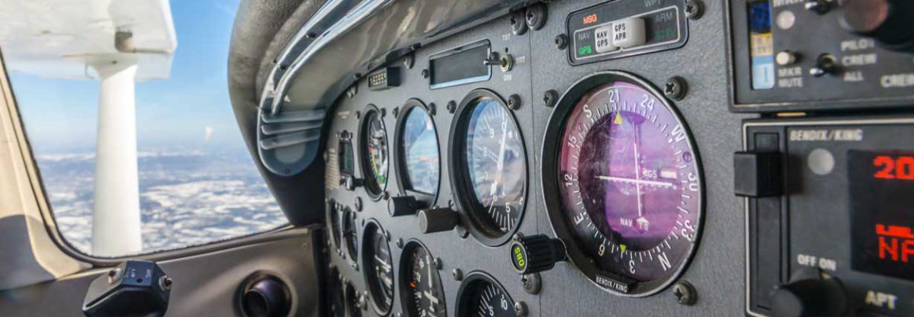
We said we could take an even altitude so he asked us to descend 8,500′. I requested instead of 8,500′ we could do 10,500′ for cloud clearance. Once approved, we started the climb from 9,500′ to 10,500′. In the summer, climb performance is a bit lowered in general and as you climb higher, the performance degrades even more. So we were only climbing at about 200′ per minute at an airspeed of 70 kts. You also must really work the mixture at this altitude. As the air becomes thinner, the mixture become excessively rich. You must lean out as you climb. This isn’t unusual but since I haven’t been this high before, it was interesting. Much easier in a SkyHawk when you have an EGT to help out.
Our path back to TTA would take us over familiar territory, albeit a lot higher. We would cross over KFAY on our way back to TTA.
At about 20 miles from KFAY, I made the request from approach to start our descent. I was concerned that we would have fewer holes below us as we approached and we had a nice path down in front of us. It also looked like clouds were scattered 3500′ the rest of the way to TTA. (We ended up flying 2500′ because clouds were lower than expected)
Approach approved the descent and handed us off to Fayetteville approach. Once on with Fayetteville approach, things started getting interesting. Lots of chatter on the radio with route deviations due to building convection. At one point we were given a vector toward restricted airspace while we were over KFAY. The vector was so that another aircraft would have time to climb over us. As we neared restricted airspace, my safety pilot suggested we give it another minute and then nudge approach that we were close to restricted. I agreed and at the same time, approach told us to turn right and resume our course towards TTA.
As we neared TTA, things looked pretty good. No echoes, there were planes in the patter and one of our club planes flying over top of us to join the RNAV 3. All of this was carefully choreographed by approach. In order to cede some room for the aircraft in the pattern and the aircraft on the RNAV, we briefed an approach from the east. The idea was that we would fly east of the field and cross over mid-field and join the downwind for runway 3. This would give the RNAV traffic time to get in and allow us to observe the pattern to safely enter.
We entered the downwind, and followed the RNAV traffic for a landing on runway 3. I was a little fast because I was concerned about a possible tailwind. This caused me to balloon slightly but I let the aircraft settle in for a soft landing. Again, not my best, not my worst.
As we tied down, my safety pilot and I debriefed what we did and what we learned. The biggest takeaway was that you always need an out. I think we did well in this regard. We had backup plans and then backups to those. We are also pretty lucky in that we have ADSB with moving maps and ability to get en-route weather. Weather that you see on the maps are delayed but it definitely helps you make strategic decisions. By the time we see small echoes, they are probably magnitudes larger in reality. You can’t rely on the data to pick your way through storms but you can use it to avoid them from a distance.
It was the first time flying with this particular pilot and I think we worked well together. I didn’t get as much flight time as I wanted today but I learned a lot more than I could have imagined. I think we added to our bag of experience and saved some from our bag of luck.
Above all, I got to fly an airplane today, at 10,500′ no less. That is always cool!
Big thank you to my awesome safety pilot. It was a luxury to have another cool head in the cockpit helping make decisions much easier. Even though we are certificated Private Pilots, we are always learning!
Leave a Reply