Learning to fly, but I ain't got wings

Month: July 2018

Building simulated instrument time and a broken transponder?

As with the last flight, todays flight was about building simulated instrument and cross country time.  I scheduled a 152 because… well… it’s slower and cheaper.  Slower means that I don’t have to fly as far to get my time in and much cheaper.

In aviation, best laid plans plans always call for a backup. Sometimes a backup to the backup.  We had planned on flying one of the same two routes as last week.

Primary route: TTA -> CRE -> EDE -> TTA

Secondary route: TTA -> CPK -> DAN ->TTA

Well as weather tends to do, it was looking like we would be thwarted on our primary and secondary.  A trough of low pressure settled into the middle of our state and was threatening some nasty weather.  As I do, I watched the weather all week and last night it wasn’t looking too good.  In the morning before the flight, my safety pilot and I got together to assess the situation.  It looked like all of the bad stuff would stay south and east of TTA until around 1-2pm and then we could expect building cumulus and afternoon thunderstorms.  The North and west was looking awesome.

So plan 3:  TTA -> SVH -> DAN -> TTA

It was about an hour and a half shorter of a trip but it kept us in good weather and close to home for the most part.  We figured that it was better than nothing and we were being safe and responsible. One thing our club instructors have drilled into us is that you never play with the weather and we were prepared to cancel our plans all together.

We get to the airfield and if you were just to gauge the sky, you would think it would be an awesome clear sky day.  Luckily, we have great weather tools that tell us otherwise.

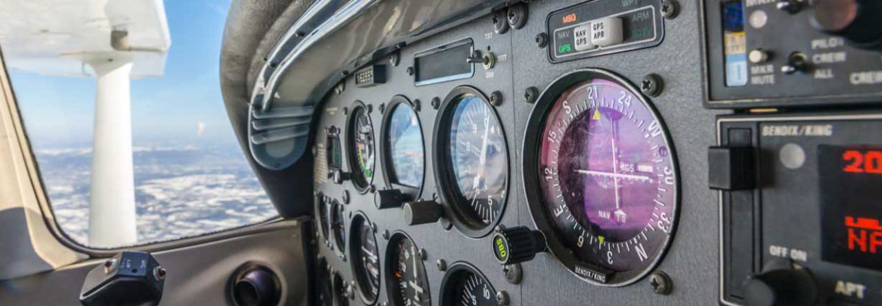
Off TTA, we climbed to 3000′, dialed up Raleigh approach, requested flight following and away we went.  The flight to Statesville (KSVH) was pretty uneventful and smooth.  The plan was to work on keeping the heading and the altitude as close as possible.  I kept altitude within 50 feet for most of the trip, a large part of that time I was within 20ft.   In the end, I was pretty pleased with myself since the 152’s are pretty twitchy beasts. ok, done patting myself on the back.

On the way to Danville (KDAN), was a little more interesting.  We climbed up to 5500′ for smooth air but turns out it was a good idea all around.  As we neared greensboro, traffic started to get pretty heavy and we were given an altitude restriction.  Turns out 5500′ was perfect because all of the traffic was around 3000′.  We also listen to a lot of chatter over a drone spotted in Greensboro’s airspace at 6000′.  PSA for Drone Pilots:  Please don’t do this.  Airspace near airports are largely crowded with aircraft in close proximity.  And more importantly, climbing and descending through a lot of altitudes that drones fly. If a drone hits an aircraft (Especially general aviation aircraft) it’s very likely to be fatal.

The rest of the flight to DAN was pretty smooth, we landed Runway 2 and taxied up for fuel.  We were greeted by a lineman who parked us and fueled us up.

Departing, I was sequenced to takeoff behind a learjet. I’m talking like there was some sort of grand plan here.  It was just that he pulled out of his spot before me, lol.

Honestly, I was a little nervous taking off behind the lear. As a precaution, we gave it several minutes and followed the climb out safety rules.  First, we made sure that we lifted off the runway at a distance before the lears takeoff point. Second, we made a quick turn as soon as were were high enough to avoid any other vortices.

On the way back to TTA, we heard some interesting chatter from a pilot stating that the first number on his transponder seemed only capable of registering a 0 or 1.  Approach asked if he had another transponder. “Negative, this is my only one.  Is it possible for you to give me a squawk that starts with 0 or 1?” Approach: “Probably not”.  That was pretty much the end of it but I thought it was pretty funny.

As we neared TTA, you could see the clouds were now building and starting to come down a bit.  We had plenty of room but our weather research and predictions were becoming reality.

We were able to make it back safely and confident in our ability to plan around the weather.  As a side note, this sort of thing is a trap that we have to be vigilant not to fall into.  This is our second trip in which we were able to plan around weather with successful outcomes.  It is easy to feel too confident in your ability to plan these things. When that happens things can start to get sloppy.  This is exactly how pilots end up in bad situations.  Even though we have had two successes we must always plan carefully and making sure we have alternate options in case things go sideways.

Totals for this flight:
3.6 Cross Country
3.2 Simulated

Overall it was a fun day of flying.  I didn’t really get to look outside much since I was flying with foggles but hey, I got to fly.


Building time and new places

Today and for the next couple of flights, it will be about building time for my IFR.  I am around 20 hrs short for cross country and simulated/actual time.  My instructor has cut me loose to fly with a safety pilot in order to get some of these hours, so I am taking advantage.

I have found a few Safety pilots that are willing to look out for me while I fly VFR with the foggles in order to get credit for simulated.  My original plan was KTTA -> KCRE -> KEDE -> KTTA which is about a 4 hour trip.  However, weather had other ideas.  I noticed that there was a low pressure being pushed across the border of NC and SC that would bring yuck weather south and up the Coast of NC.  Once I accepted this would be more probable than not, I planned an alternate path.

We ended up with plan B, KTTA -> KCPK -> KDAN -> KTTA.  This would take us northerly still within the dominate high pressure area and away from the yuck.

We preflighted and jumped in the skyhawk, me the pilot and a pilot friend of mine as the safety pilot.  We briefed responsibilities, I was PIC, he was PIC as well when I was under the hood.  He was responsible for safety of flight. In an emergency, I would have the controls, he would have the checklist and troubleshoot. Crew resource management was the name of the game.

We departed at 10:00 am and headed for KCPK (Chesapeake Regional Airport) at 5500′.  I picked up flight following from Raleigh Approach and we were on our way.  Pretty uneventful trip, that terminated with an RNAV 5 approach at KCPK.

Once on the ground, we taxied to refuel.  After refueling, we used the facilities and checked the weather… all was good.  After a few minutes troubleshooting why our secondary comms were not turning on, (Turns out was a bad switch that had to be coaxed a little) we prepped for our trip to KDAN (Danville).

Once we were airborne, I picked up following from Norfolk approach.  We stayed at 3000 feet due to clouds.  The ride was more bumpy and I had to work more under the hood, but pleasant and uneventful.  We finished this leg with an RNAV 20 approach at KDAN.

After refueling, we departed on our final short leg back to KTTA.  When we were 5 miles from KTTA, I pulled the hood off and made a normal crosswind landing on runway 3.

Total Trip time: 4.4

Simulated time: 3.8

As you can see, I spent quite a bit of time simulated today. Honestly, it wasn’t that bad.  I remember back during my private, simulated would exhaust me. Today I felt pretty good.  I guess it means that I am starting to get the hang of the scan and workload.

I think the main takeaway from this trip is that I was able to practice all of the things my instructor has trained me to do.  Like setting up navigation and radios, thinking ahead to the next event, briefing the approach, talking with ATC.  Even though I was only on flight following, I made requests for altitude changes, requests for the approaches, etc.  I was vectored or given direct to the approaches just like when we are on an IFR clearance.  It helped me build some confidence and I felt like a real pilot using the tools of the trade.

All in all it was a good day.  I got to fly and airplane… a lot…. under the hood.  And I made some much needed progress towards my instrument rating!

Enjoy some pics from todays flight:

IMG_0811
IMG_0812
IMG_0815
IMG_0814

Back in the foggles, first localizer back course

Today’s lesson had me back in the foggles for a quick trip to Fayetteville (KFAY).  With the rise of GPS approaches, localizer back courses will soon be a thing of the past so it is cool to try them while they exist.

I arrived at the airfield and performed the pre-flight like normal.  My instructor asked me to check KFAY to see if the winds favor the Loc 22 BC.  Indeed they were.  We have talked about doing this approach for the last couple of lessons but one thing or another has caused us to change plans.  Mostly my club annual that I have mention about a million times.  Don’t worry, it’s done.  I won’t mention it anymore…. I promise.

Until next year…

So we jumped in the airplane and started our flight preparations.  I was able to setup the radios and our initial navigation mostly on my own.  My instructor had to prompt me a few times with phrases like… “What else can we setup ahead of time?”  I am starting to get better on the preparation but still have to button down a few things.

I set the primary and en-route radios, including the Localizer frequency for the approach.  Loaded up our initial flight plan, a simple direction KTTA->KFAY.

As we departed, my instructor gave me an initial altitude of 2500 and when I asked if we should turn toward KFAY, “You’re cleared direct to KFAY at 2500” and we were on our way.  I reached over and re-sequenced direct to KFAY and performed the match-set operations.  My instructor helped out by checking the ATIS and we were current with information Zulu.

At this point, I am thinking, how do I get ahead of the airplane.  Looking back, this in itself is progress.  Not too long ago, I was almost saturated and could barely think about what is next.  Anyway, back on point.  In futility, I tried to see if I could recognize the localizer, and since we were still pretty far away, no dice, makes sense.

Next, I called up Fayetteville approach. I did ok with the radio call here.  I was supplied a squawk code and and I asked for the localizer 22 BC practice approach.

After this we were given a vector.  During the next few minutes, I loaded up the localizer 22 BC approach plate and briefed. I started to really just skip over the frequency section.  My instructor made a point to make sure that we go over each of the fields.  This is good because I set these before we departed TTA.  If I skip that part on the brief or gloss over it, I may not catch a potential error.

At this point we get a call that we are cleared for the approach, on the missed, I was instructed to  climb runway heading to 2000 and contact approach on 133.0.  I briefed the rest of the approach and when I got to the missed approach section, my instructor said… “Are you sure?”  Doh, yeah I have the missed approach instructions from ATC and I read back those.

As we approached the localizer intercept, we were given another vector to establish and instructions that we were cleared for the approach.  Once established I made the call that we were established and the controller told us to change to tower frequency.  Once on tower we were cleared for the option.

I didn’t have too much of an issue with the reverse sensing.  I remarked as we got closer that you can really see the sensitivity.  I had read previously that it is really sensitive because the front course localizer antenna is actually broadcasting from the departure end of the runway. Since we were on the back course, that meant that it was near the approach end on our side, thus really sensitive.

I reached my minimums around this time so my instructor said “Hang here for a bit and let’s see how sensitive it gets”  I was splitting degrees to stay on course.  Cool.

Once I looked up, it was pretty neat to see the runway right there but also that a regional jet was holding short waiting on my slow little skyhawk to get on with it.

We went ahead and declared the missed and started the climb back to 2000 on runway heading.  Once back over to Fayettville approach, we were vectored back to TTA and cleared to IKTOW for the ILS LOC 03 Y approach.

As I was loading the approach, the GPS asks the question if we want to perform the procedure turn.  My instructor said “Do we want to?”  At first I said no because we were on the side of the hold entry that we don’t need to.  Really, I thought he was asking me if I wanted to do it.  It was a good lesson on identifying if you have to perform the procedure turn and we discussed more in debrief.

There are 5 times that you don’t have to perform the Procedure turn.

  • Vectors to final
  • Cleared for the straight in approach
  • We find “NoPT” on the plan view of the approach chart                            (And we did for IKTOW in the direction we were heading)
  • You are on a DME Arc
  • Timed approaches from a holding fix

This is where I had my biggest brain fart of the day.  I thought we talked about doing the LOC 03 Y approach and when I briefed, I started briefing the step down by identifying AMIRS.  It turns out, and if I listened, “You are cleared for the ILS 03 Y approach”.  The ILS is easier, though I was probably more off the needles this time than any other.  Slightly high and left.

It did prompt a good discussion in debrief about whether or not we can identify AMIRS. This comes down to the difference in having a DME vs GPS only.  The short of it is that we can’t use AMIRS without a real DME on board and calculating the distances is unacceptable.

All in all it was a good flight.  There were highs and lows, no pun intended. In the end, flying always puts me in a good mood.


Finishing up my club annual and a peek at the future

Today was a really short lesson, all about finishing up my club annual .  I need to finished up before my instructor heads out of town for vacation.  This way, I can get in some cross country flights with a safety pilot. This will help met get some of my last IFR requirements out of the way.

In the previous few lessons, we took care of a lot of the items on the club annual.  After looking over the checklist, we found that I really only needed emergency engine out testing.  With weather coming in, I decided we could just go do those real quick and let my instructors other students start a little earlier.

We were going to stay in the pattern, so I was mentally prepared to have the engine “Fail” at any moment.  There was quite a bit of traffic at the airfield at the time, so I was able to predict, with some accuracy, when the engine failure would come.  That and my instructor giving me some really good hints as to what, when and where.

For the first maneuver, I was instructed to climb to 2000 and we performed a spiral down engine out maneuver over the numbers.  I have done this once in the past during my private pre-solo check with the chief flight instructor.  I did a little better then than I did this time.  My instructor said “pick a spot” and fumbled around a bit but went with the numbers as to what I would aim for.  I am pretty sure he was setting me up for the big lesson on the next attempt.

As I descended down lower and lower, I decided that we couldn’t make another 360 and we would go for it. I should have extended the downwind on that last turn a bit to set up for a more natural approach to the threshold but instead I dropped full flaps and tried to slip down.  Now you have to understand, when I started this, I was already over the landing point that I said I was aiming for.  Do you think I could make that spot?  ha, …. no.  I am not even sure I could have made the end of the 6000′ runway but we decided to go around before trying.

Now the cool part.  This time we went up to pattern altitude and performed a power-off 180 accuracy landing.  A maneuver that you learn during your commercial training (Which is coming up after my IFR).  This maneuver involved pulling the throttle downwind abeam your touchdown aim point, in our case the 1000 ft markers.  When you turn base, you judge your height (too high? too low?) and you can use S turns in order to better lose altitude until you are right on target.

We performed this maneuver two times and hit the 1000 ft marker both times.  Before this, I only had a few tools in my bag, judging distance on the downwind, flaps and slips.  By adding S turns, you can use the bank as a way to lose some lift. This allows you to better control distance between you and the touchdown point.

It was a great lesson in energy management and a really cool peek into my future training.

Next on my list is knocking out about 20 hours or cross country and simulated instrument time. I am planning some long cross country flights with a safety pilot to try and get some significant hours.  Should be a lot of fun.

The check ride is coming soon and honestly, I have had so much fun that am not sure I want it to end, lol.  However, my instructor is awesome and we are already talking about the commercial so there will be more fun to be had!

I got to fly again, whoa, I’m crusty… err rusty

Today I got to fly again.  It seems like forever between vacations, schedule conflicts etc.  In reality it has only been a little over a month.  I think it was a good lesson in that I gained some confidence but also because I got to see rust in IFR flying.

By the regulations, you are IFR current if you have performed 6 approaches and holds in either actual or simulated conditions in the past 6 months.  This is one of those weird things that just because you can, doesn’t mean you should.  Even though you are technically current, doesn’t mean you are really ready to launch off into the clouds.

Today, the clouds were decently low so we decided to file a round robin IFR to KHNZ Henderson-Oxford (Which btw, I sucked at remembering the name)

I filed the flight plan, (forgot to do round robin, more on that) and headed out to turn money into noise.  Run-up went fine and as I called for my clearance, the first bit of rust showed.  I called up Raleigh approach and asked to pickup my flight plan….. sigh… I should have asked to pickup my clearance.  Ok no biggie, however we were asked if we could take off and pickup the clearance in the air since the field was already locked due to an incoming aircraft on IFR.  We decided we needed to wait so they asked us to call back in 10 minutes.  ugh.

After thinking about it for a minute, my instructor looked at the weather again and decided that we could try to pick it up in the air.  We departed and I performed a soft field takeoff (I am in need of a club annual so we are going to do some things to help that out).  Once we were aloft, I made the call to approach to pick up the clearance.  We got a squawk code and after a minute or so, we were given a vector and altitude.

Since I actually failed to file Round robin, we discussed how to request the amended clearance.  I made the call and they amended us for the round robin and asked which approach we would like.  I requested the LOC 6 approach and we were on our way.

I had decided earlier that I wanted do the hold so we discussed how to ask for the hold.  At the appropriate point, I asked for and received the hold on the LOC 6 appraoch.  We were flying at 5000 and pretty much IMC for the the duration of the trip to KHNZ.

Preparing for the arrival, I setup the radios, checked that the localizer was tuned on the primary and en-route radios and set the CDI.  I then briefed the approach.  This part of the flight started feeling better.  My radio calls were sometimes… um… terrible.

Once we arrived, I donned the foggles to make sure that I would get credit for the approach and performed the hold and then turned inbound on the localizer.  I performed the step downs to minimums and voila…. runway right where it is supposed to be.

Making the inbound radio calls I kept forgetting the name of the airport, Henderson-Oxford.  Even while writing this I have to look it up.. ugh.  In the future, I will write this down on my kneeboard.

The landing went well, performed a soft-field landing and followed up by short field take off ( more club annual work).  I performed the missed approached and called Raleigh approach up to get back to TTA.  I was given an altitude and vector.  We asked and received the RNAV 21 and we were vectored to YUXI.  It was my request to perform the RNAV 21 is because I wanted to do the circle to land.

The approach was pretty uneventful and I followed the RNAV LPV glide path down to the circle to land minimums.  To finish the approach I completed a short field landing.

Overall, I think I did well today.  I was very rusty, with my scan and with my radio work.  I think I did pretty well in the areas of configuring to land, briefings, etc.

As I stated at the beginning, it was a good lesson in how you can quickly that you get rusty and even though you are technically current in the FAA eyes, doesn’t mean that you capable.  I will take this lesson with me for the remainder of my aviation career and hopefully guide me in making better Aeronautical decisions in the future.

Powered by WordPress & Theme by Anders Norén